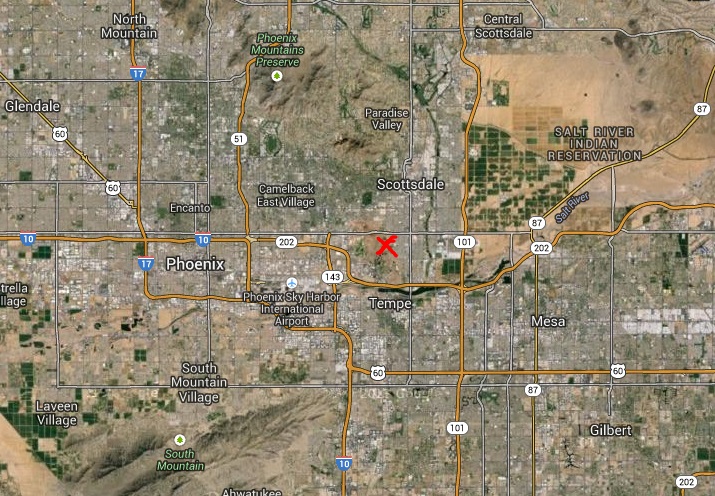
Map of Phoenix Metro Area
The following map is a high level map of the Phoenix metro area. The red X is where the attempted murder occured.The attempted murder occured along the Phoenix and Scottsdale border, just south of McDowell Road, just west of the Cross Cut Canal, and just east of Papago Park and the Desert Bontanical Garden.
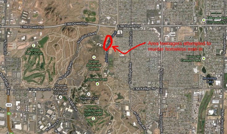
Map of the local area
The following map shows the local area around the attempted murder of a homeless person occured.The area where the attempted murder occured is circled in red.
Again the area is on the Phoenix, Scottsdale border. It is just south of McDowell Road. Just west of the CrossCut Canal. Just east of Galvin Parkway in Phoenix, which is Priest Drive in Tempe, and 64th Street in Scottsdale. The closest streets to the south would be Roosevelt Street in Phoenix and Scottsdale or Continental Drive in Tempe. But neither Roosevelt or Continental cuts thru Papago Park. The closest street to the south that goes thru would be Washington in Phoenix and Curry Road in Tempe back to triple column table baback to triple column table
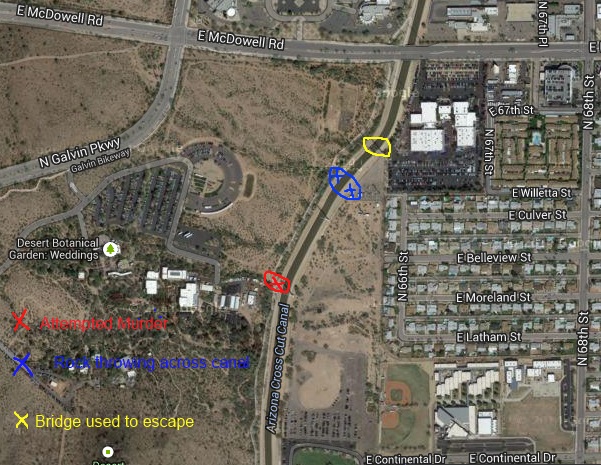
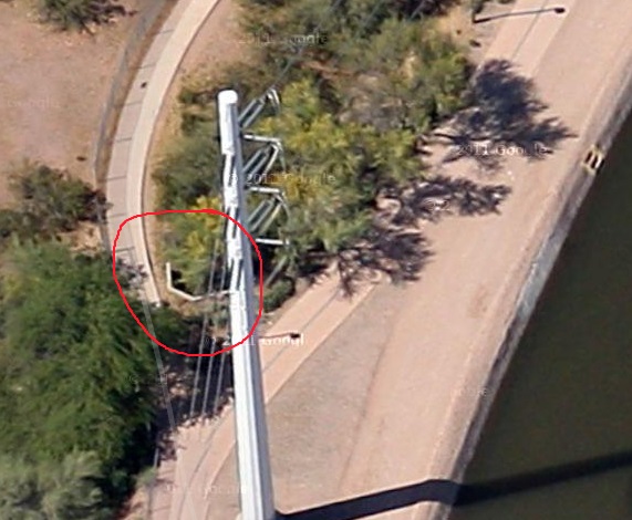
Detailed map of where the attempted murder occured
The red circle and red X is where teenagers attempted to stone the homeless man to death. It's about a quarter or fourth of a mile south of McDowell. It's around where Moreland or Bellview Streets are in Phoenix or Scottsdale.
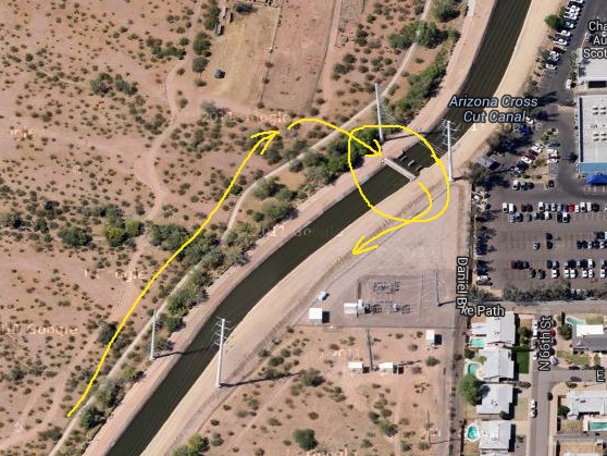
After their failed attempt to stone the homeless man to death while he was sleeping the teenagers or young adults retreated north and crossed the pesdirian bridge which is circled in yellow from the west side of the CrossCut Canal to the east side of the CrossCut Canal and then headed south, where it is suspect is the way to their home.
By then the homeless man was following the teenagers in an attempt to figure out where they live so they can be arrested and to prevent more attempts on his life.
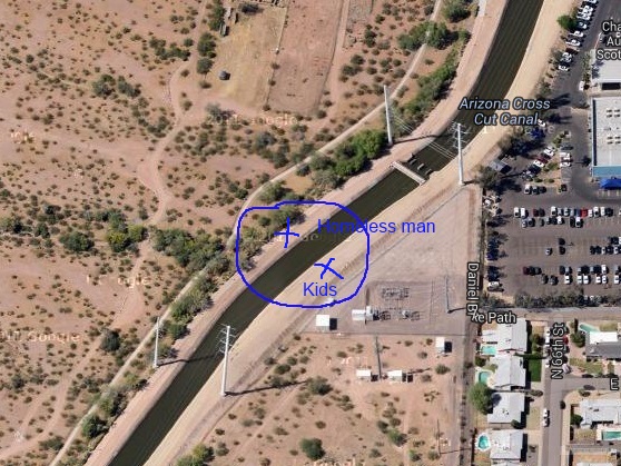
This second murder attempt occured where the blue circle and two blue X's are on the map.
The teenagers were on the east side of the Cross Cut Canal throwing large rocks at the homeless man who was on the west side of the Crosscut Canal.
Map of where they tried to stone the homeless man to death
The homeless man was sleeping in the flood control ditch circled in red.
You can't see the flood control ditch or canal because it is blocked by trees in this photo from Google maps.
Those trees are no longer there, so it appears the satellite image on Google maps was taken long before this attempted murder.
Map of the second attempted murder
The homeless man was now following the teenagers who attempted to stone him to death.
The homeless man was on the west side of the Cross Cut Canal in Phoenix, and the teenagers were on the east side of the Cross Cut Canal in Scottsdale.
The teenagers were grabbing rocks from the side of the canal and throwing them from the east side of the canal to the west side of the canal in a second attempt to kill the homeless man.
The kids were throwing so many rocks, so quickly that the homeless man suspect there might have been more then two teenagers who attempted to murder him.
This is where the homeless man got a good look at the teenager. In fact he got a good enought look at them that he can identify them.
They were two relativelly tall teenagers, with kinda sorta long hair. Not long haired Charlie Manson style hair, but just long hair that is normally worn by guys. Also they were clearly teenagers or young adults, probably high school or college age.
A little bit to the north and east of the area circled in blue, between the two high volatage electric towers is the foot bridge where the teenagers or young adults crossed the canal during their escape from the attempted murder. We will get to that in the next photos.
The foot bridge used in the escape
In their failed attempt to murder the homeless man the kids hit the man with one big rock in his face which would have blinded him if it hit an inch or so higher.
But other then that they didn't do any damage.
They quickly fled. Probably back home so mommy and daddy would not know that at night they have a sadistic mean hobby of attempting to murder homeless people.
The homeless man witnessed the two teenager walk north along the CrossCut Canal where they crossed the footbridge circled in yellow from Phoenix into Scottsdale.
The kids then went south again on the Scottsdale and Tempe side of the CrossCut Canal.
Where the yellow arrow ends on the east side of the canal the kids made one final attempt to stone the homeless man to death a second time.
We suspect the kids live either with mommy and daddy in a home in the Scottsdale or Tempe area just to the east of the CrossCut Canal.
Or perhaps the kids are students at Arizona State University and have rented a house or apartment in the area and live with their buddies who don't know their roommates are wanna be Charles Manons.
On the other hand who knows, maybe these kids are serial killers and have murdered homeless people before.